Maps
After signs, maps are the most common visual communication aids deployed in airports.
︎︎︎ Related entries:
PA Announcements
Signage
Artwork
︎ Random Entry
Tags: systems design, wayfinding,
sensory (visual), directionality
PA Announcements
Signage
Artwork
︎ Random Entry
Tags: systems design, wayfinding,
sensory (visual), directionality
Design Decisions
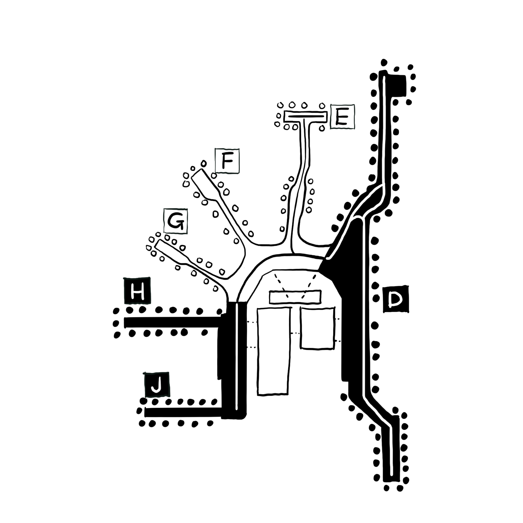
In his seminal 1960 text The Vision of the City, Kevin Lynch defines wayfinding as “consistent use and organisation of sensory cues from the external environment in order to reach a desired destination” [2]. Effective wayfinding results from a successful interplay between human factors and environmental conditions. Human factors include things such as an individual's aptitude for particular cognitive mapping and spatial orientation, while environmental factors include paths, landmarks, layout complexity and visual aids [3]. After signs, maps are the most common visual communication aids deployed in airports.
Despite the popularity of maps as wayfinding devices, there is little published research devoted to the theory of map design. Maps can take many different forms, such as plans, views, fantasy drawings, You Are Here (YAH) maps or sometimes a combination of several types [4]. YAH maps are presented in two primary ways - those requiring metal rotation and those that are pre-aligned to an assumed orientation of the viewer.
Recently, companies such as TripIt have developed interactive airport maps that can be navigated via an app on one’s phone [5]. The general promise of this sort of personalized navigation is the removal of the uncertainty and challenge that many passengers feel when attempting to navigate the complex space of the airport terminal with conventional maps.
Are there shapes, forms, or arrangements of space that are inherently easier or more pleasurable to navigate?
Effects on Passengers
Research has established quantitative methods for evaluating how easily a person can navigate a particular space, through sight line analysis. It is based on the premise that orientation is a function of the visibility of a destination (ie. sight lines) [6]. More recent approaches have employed Bayesian networks to integrate analysis of human and environmental factors in wayfinding [7]. The research demonstrates that human factors play a larger role, and “spatial anxiety” has the largest impact on a passengers ability to successfully navigate an airport.
Studies have shown that people are not always equipped with the tools to navigate 3D space from 2D drawings, or understand directional arrows.
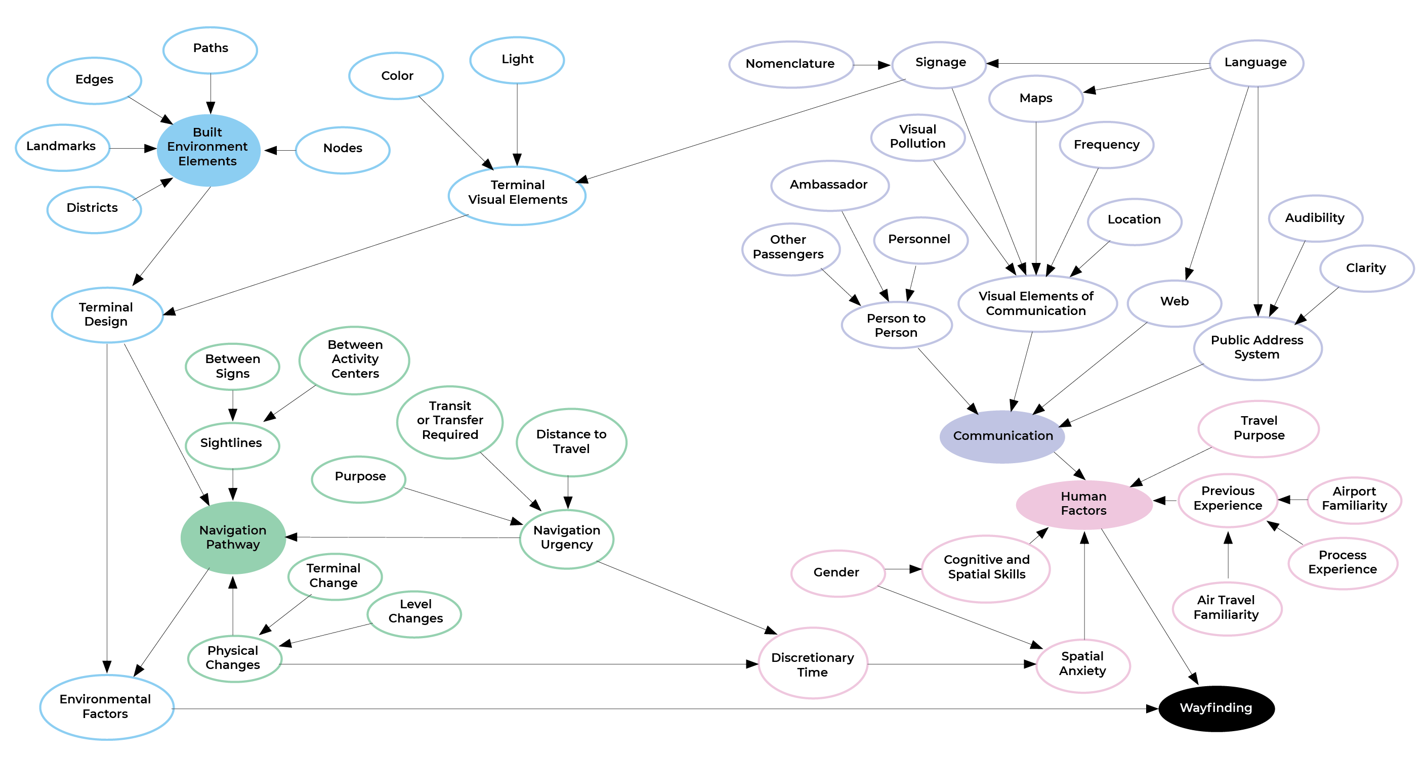
The Wayfinding Bayesian Network diagram, showing the interrelation and conditional dependency of human and environmental factors in wayfinding abilities. Arrows show the direction of dependencies.


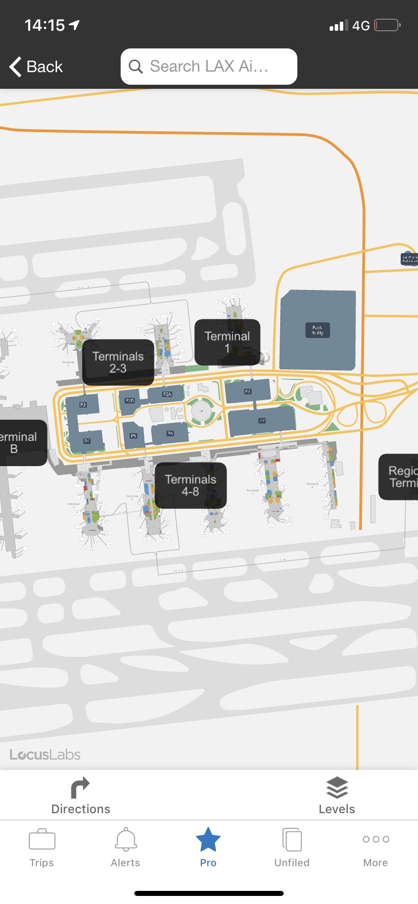
TripIt provides interactive airport maps as an app on one’s phone.
- Modak, S. K., and V. N. Patkar. 1984. “Transport Terminal Design and Passenger Orientation.” Transportation Planning and Technology 9 (2): 115–123.
-
Lynch, K. 1960. The Image of the City. The MIT Press. 194 p.
-
Farr, A. C.; Kleinschmidt, T.; Yarlagadda, P.; Mengersen, K. 2012. “Wayfinding: a simple concept, a complex process”, Transport Reviews 32(6): 715–743.
-
Fewings, Rodney. 2001. “Wayfinding and Airport Terminal Design.” The Journal of Navigation 54 (2): 177–84.
-
“TripIt - Highest-Rated Trip Planner and Flight Tracker.” n.d. Tripit. Accessed November 2, 2019.
-
Braaksma, John P., and W. Jordan Cook. 1980. “Human Orientation in Transportation Terminals.” Transportation Engineering Journal of ASCE 106 (2): 189–203.
- Farr, Anna Charisse, Tristan Kleinschmidt, Sandra Johnson, Prasad K. D. V. Yarlagadda, and Kerrie Mengersen. 2014. “Investigating Effective Wayfinding in Airports: A Bayesian Network Approach.” Transport 29 (1): 90–99.